
|
|

| Historic Maps of the Marshall Islands |
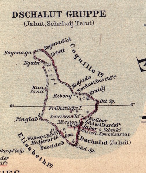 Map of Jaluit Atoll, taken from the 1893 map 'Schutzgebiet der Marshall Inseln', published in 1897. |
Source:Langhans, Paul (1897) Deutscher Kolonial-atlas. 30 Karten mit 300 Nebenkarten. Gotha: Justus Perthes. Map 30 'Schutzgebiet der Marshall Inseln' |
[Historic Maps]CONTACT: Dirk H.R. Spennemann, Institute of Land, Water and Society, Charles Sturt University, P.O.Box 789, Albury NSW 2640, Australia. e-mail: dspennemann@csu.edu.au |
| select from the following... | ||||||
| |
||||||
|
Digital Micronesia-An
Electronic
Library & Archive
is provided free of charge
as an advertising-free
information service
for the world community. It is being maintained by Dirk
HR Spennemann, Associate
Professor in Cultural
Heritage Management, Institute of Land, Water and Society and School
of Environmental & Information Sciences, Charles
Sturt University,
Albury, Australia. The server
space and technical support are provided by Charles
Sturt University as part of its commitment
to regional engagement. Environmental
SciencesInformation
Sciences
|
||||||
| Mon Mar 03 2025 23:33:53 GMT+0000 (Coordinated Universal Time). | ||||||